
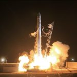



India’s NavIC system is being strengthened with the recent launch of the NVS-03 satellite by ISRO. This advancement promises to enhance navigation services across the region.
Overview of India’s NavIC System
India’s NavIC system, developed by the Indian Space Research Organisation (ISRO), is a regional satellite navigation system that provides accurate positioning services to users in India and the surrounding region. It aims to offer an alternative to global navigation systems like GPS, ensuring that users have access to reliable navigation data.
The NavIC system comprises a constellation of satellites working in tandem to deliver positioning information with high precision. The recent launch of the NVS-03 satellite enhances the system’s capabilities, contributing to improved accuracy and reliability of navigation services.
Key features of India’s NavIC system include:
- Regional Coverage: Primarily serving India and surrounding regions.
- High Accuracy: Offers positioning accuracy of less than 20 meters.
- Robustness: Designed to function effectively in challenging environments, including urban canyons.
As India continues to develop its satellite technology, the NavIC system is poised to become a crucial component of the country’s navigation infrastructure, providing reliable services for various applications.
Importance of NVS-03 Satellite
The recent launch of the NVS-03 satellite marks a significant milestone in enhancing India’s NavIC system. This satellite plays a crucial role in improving the accuracy and reliability of navigation services across the region.
One of the key features of the NVS-03 satellite is its advanced atomic clock, which provides precise timekeeping. This is essential for maintaining accurate positioning data and is a substantial upgrade over previous satellites in the NavIC constellation.
The NVS-03 is also equipped with enhanced signal capabilities, which will benefit various applications such as:
- Personal navigation: Helping users find their way in urban and rural environments.
- Agriculture: Providing farmers with better data for precision farming techniques.
- Disaster management: Assisting in timely response and planning during natural calamities.
Overall, the NVS-03 satellite significantly strengthens India’s NavIC system, making it a robust solution for satellite navigation in the region.
ISRO’s Recent Achievements
In recent months, the Indian Space Research Organisation (ISRO) has marked significant milestones, particularly with the successful launch of the NVS-03 satellite. This advancement strengthens India’s NavIC system, enhancing its capabilities in providing precise positioning services.
ISRO has been at the forefront of satellite technology, and the launch of NVS-03 is a testament to its commitment to improving the NavIC system. The satellite, equipped with advanced features, is designed to deliver better accuracy and reliability for users in India and surrounding regions.
Key achievements from ISRO include:
- Successful Launch Operations: NVS-03 was launched with precision, showcasing ISRO’s technical prowess.
- Enhanced Navigation Services: The integration of NVS-03 into the NavIC system is expected to significantly improve navigation accuracy.
- International Collaboration: ISRO continues to collaborate with global agencies to enhance satellite technology.
These accomplishments position India’s NavIC system as a leading solution for satellite navigation, catering to a growing demand for reliable service.
Future of Navigation in India
The future of navigation in India is poised for significant advancements, primarily due to the continued development of India’s NavIC system. As the nation embraces burgeoning technology, the integration of satellite-based navigation will play a crucial role in enhancing various sectors.
With the recent launch of the NVS-03 satellite, ISRO is set to bolster the capabilities of NavIC, providing improved accuracy and reliability for users across the country. This system not only serves civilian purposes but also strengthens national security and disaster management initiatives.
Key areas where India’s NavIC system is expected to make a substantial impact include:
- Transportation: Enhancing logistics and reducing travel times through precise navigation.
- Agriculture: Assisting farmers with accurate land mapping and crop management.
- Telecommunications: Supporting seamless connectivity across rural and urban areas.
As ISRO continues to innovate, the future of navigation in India looks promising, with the NavIC system at the forefront of these advancements.
How NavIC Compares to GPS
India’s NavIC system has emerged as a competitive alternative to the widely used Global Positioning System (GPS). While GPS has been the go-to navigation solution globally, NavIC offers several advantages that cater specifically to the Indian subcontinent and nearby regions.
One of the primary benefits of NavIC is its enhanced accuracy and reliability in urban and rural environments. It operates with a positioning accuracy of around 5 meters, which is comparable to GPS, but its regional focus allows for improved performance in the Indian context. Additionally, NavIC is designed to function effectively even in challenging conditions, such as dense urban areas and mountainous terrain.
Moreover, NavIC is less susceptible to signal disruption, making it a more robust option for users in India. The system also supports various applications, from navigation for vehicles to precise timing for telecommunications.
In summary, while GPS remains the dominant global navigation system, India’s NavIC system is proving to be a strong contender, particularly for users in India and surrounding regions.
Challenges in Satellite Navigation
Despite the advancements made by India’s NavIC system, several challenges persist in the realm of satellite navigation. These challenges can impact the effectiveness and reliability of the system.
- Signal Coverage: One of the primary challenges is the limited coverage area, as NavIC primarily serves India and the surrounding region. This restricts its use for global navigation applications.
- Interference Issues: NavIC signals can be susceptible to interference, which can affect accuracy and reliability, especially in urban environments with high-rise buildings.
- Technological Competition: As global navigation systems like GPS and Galileo continue to evolve, NavIC must keep pace with technological advancements to remain competitive.
- Awareness and Adoption: The integration of NavIC into consumer devices is still in progress, and increased awareness among users is essential for broader adoption.
Addressing these challenges is crucial for enhancing the capabilities of India’s NavIC system and ensuring it serves as a robust solution for satellite navigation in the future.
Public Response to NVS-03 Launch
The launch of the NVS-03 satellite has garnered significant public attention and sparked discussions about India’s NavIC system. Many citizens expressed excitement over the advancements in satellite technology and its implications for navigation services.
Social media platforms were abuzz with reactions, with users sharing their optimism regarding the improved accuracy and reliability of India’s NavIC system after the launch. Some noted that this development could enhance various sectors, including transportation and agriculture.
In a recent survey, a majority of respondents stated they believe the NavIC system would be a game-changer for India, providing robust alternatives to existing global navigation systems. Key highlights from the public response include:
- Increased Trust: Many users feel more confident in relying on indigenous technology.
- Global Positioning: The satellite launch has prompted discussions about India’s position in the global space race.
- Future Prospects: Enthusiasm about potential collaborations and innovations stemming from the enhanced NavIC capabilities.
Overall, the public’s response reflects a growing awareness and appreciation for India’s efforts in satellite navigation technology.